Record on the phone
The phone’s GPS receiver can calculate location without a cellular data connection. Bikepacking Live can validate and hold accepted ride points locally while the stage is recording.
Result: the route can catch up later.Offline-friendly bikepacking tracker
GPS recording and live transmission are different jobs. Bikepacking Live keeps accepted ride points on the phone during a mobile-data gap, then synchronises them when reception returns. Followers see the last point that truly arrived.
A route through changing coverage
The production router generated this 31.7 km bicycle stage from Freiburg to Titisee. It makes the offline distinction concrete: GPS points can be accepted and queued locally even when the phone cannot upload them.
Bikepacking Live preserves the route record through intermittent coverage and synchronises later. It does not turn a phone into a satellite device. Create an account to save the trip, then test your exact phone before riding remotely.
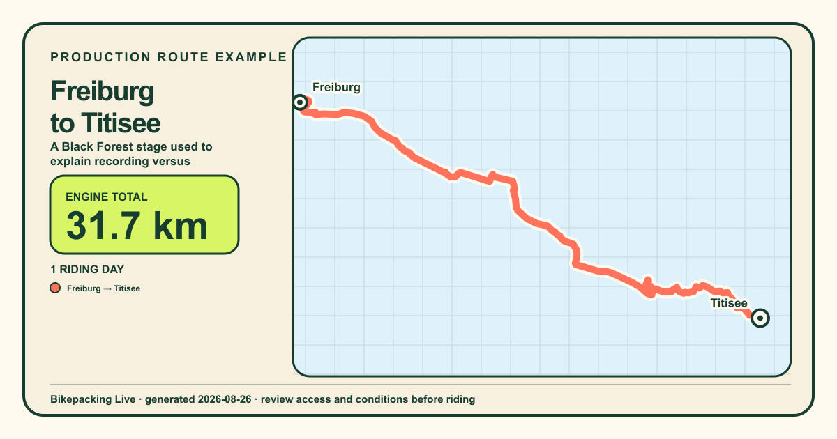 GENERATED 2026-08-26
Generated with the same production bicycle router used by Bikepacking Live. Always verify current access, surfaces, closures, weather, and local conditions before riding.
The important distinction
The phone’s GPS receiver can calculate location without a cellular data connection. Bikepacking Live can validate and hold accepted ride points locally while the stage is recording.
Result: the route can catch up later.A phone cannot upload through a network that is not available. During the gap, the follower page remains on the last received point and shows how old that update is.
Result: no new live position until reconnection.What works in a dead zone?
Example · a 25-minute coverage gap
At 09:06 the last point reaches home. The rider continues through a valley and 63 accepted points wait on the phone. At 09:31 mobile data returns; those points upload in sequence and the missing piece of route appears.
During those 25 minutes, home sees “last updated 25 minutes ago.” That timestamp matters more than an animated guess.
Before a remote stage
Carry offline maps or the route on a bike computer. Bikepacking Live is not your only navigation system.
Check permissions, background recording, battery use, and the exact phone you will take.
Bring appropriate charging capacity and keep cold, heat, and screen use in mind.
Tell family that an old timestamp is not automatically an emergency and define the real check-in plan.
For remote terrain, use suitable emergency equipment and a satellite plan rather than relying on cellular tracking.
Safety, without fine-print theatre
GPS, batteries, phone operating systems, mobile networks, and the app itself can fail. Bikepacking Live provides a ride record and optional follower view; it must never be the only way you navigate, communicate, or call for help.
Offline tracking questions
Many phones can still receive GPS in airplane mode, but exact behaviour, background permissions, and battery use vary. Test your specific device before the trip.
Accepted queued points are designed to synchronise when connectivity returns. Keep the app and phone in a healthy state and verify the stage after a long outage.
Not from phone data alone. They see the last received update until the phone reconnects. A compatible satellite communicator is the appropriate category for off-grid transmission.
Do not assume the follower map or planning map replaces downloaded navigation. Carry offline maps or a dedicated bike-computer route for the stage.
Plan for the gap
Organise every stage privately, record with the native app, and share live only with an honest understanding of connectivity.